Truck navigation is tricky for drivers because semitrailers are long and heavy and it takes a 40-acre field to turn around sometimes. And bridges aren’t our best friends.
Drivers are warned of low clearances, non-truck routes, weighted highways and areas that are not truck accessible. Given live traffic updates, including road closures, and current weather conditions, truck drivers are able to choose their routes accordingly.
Truck navigation is such a preventative tool every mile.
I have been a Garmin GPS girl for the last 13 years. I even still have my 5-inch Garmin that has been dropped out of my truck and bounced down the highway for several miles, but it still works perfectly.

Recently, I have been running a Garmin Dezl 785 dashcam and GPS, which was the latest version when I purchased it in 2021. And when I heard there was a big Garmin GPS upgrade, I couldn’t wait to see the improvements.
Here’s a look at the Garmin Dezl OTR810:
| GENERAL SPECIFICATIONS | |
| Price | $699 |
| Dimension | 7.87″ W x 4.92″ H x 0.79″ D (20.0 x 12.5 x 2.0 cm) |
| Display size | 6.8″ W x 4.2″ H (17.2 x 10.7 cm); 8″ (20.3 cm) diagonal |
| Display Resolution | 1280 x 800 pixels |
| Display type | 8-inch-wide view IPS, color TFT, with on-cell capacitive touch panel |
| Dual-orientation display | Yes |
| Weight | 14.3 ounces (405 grams) |
| Battery type | Rechargeable lithium-ion |
| Battery life | Up to 2 hours |
| Magnetic mount | Yes |
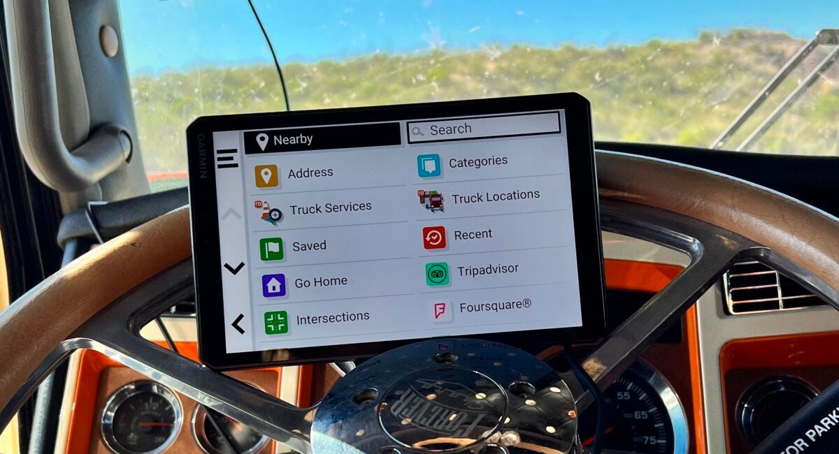
Unpacking and setting up the Dezl OTR810 was pretty simple, but make sure you have a good Wi-Fi connection.
It has a flat, crisp 8-inch full screen that you can turn into a landscape or portrait, and the color and detail is highly improved.
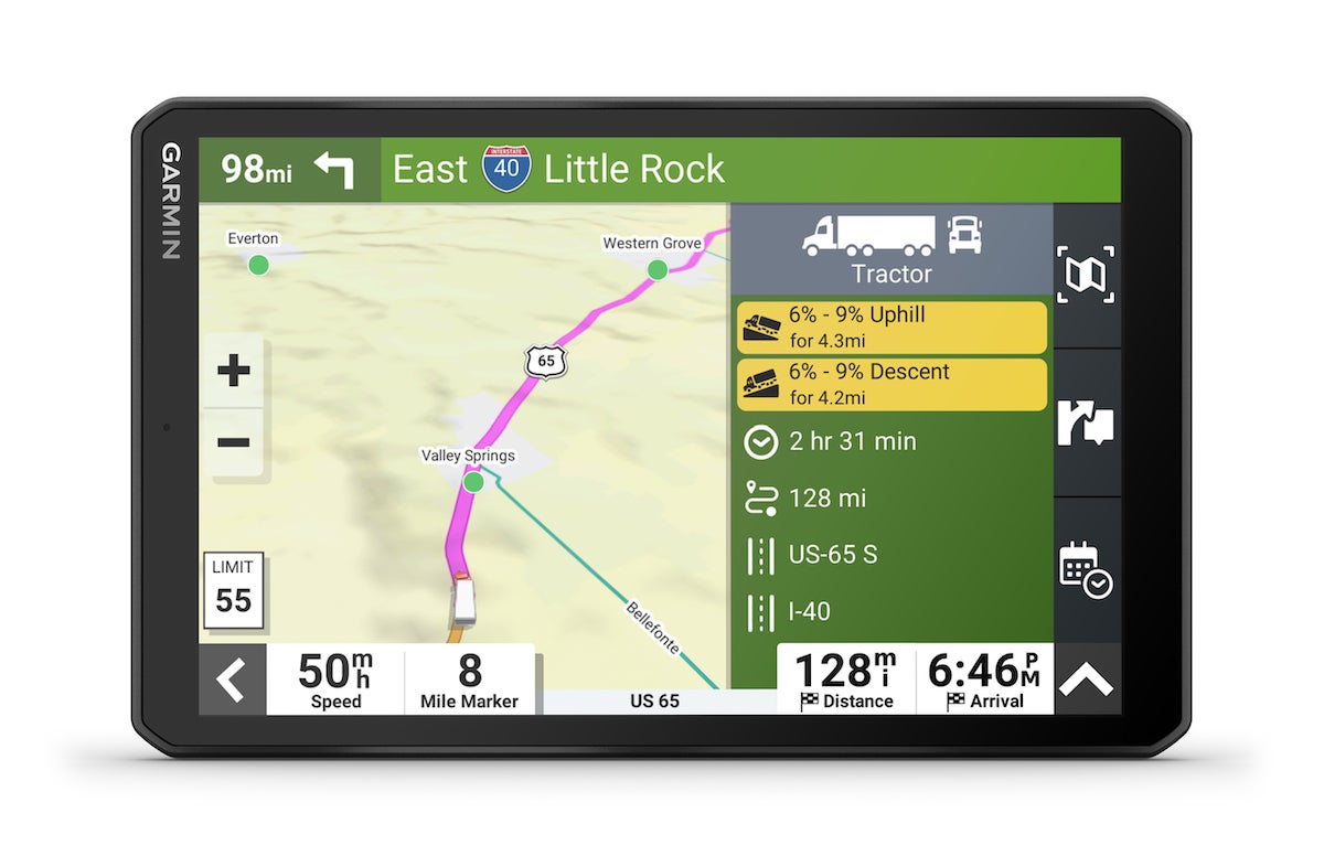
The standard truck gross vehicle weight and trailer length has manual as well as fixed options. Making sure your route provides details of no u-turns, ferries, highways or dirt roads is a breeze. And setting the fastest or shortest mileage route is also easy.
The only thing lacking is a personal preference and is really not that important — I couldn’t find how to change my icon on the map.
Yes, I love having my truck and trailer as my icon and it also reminds me that I am in truck-routing mode — just as when I am in car-routing mode with my little blue car icon. I googled and chased every lead I could find in the online manual but never found my truck or car icon, so I had to settle for an arrow. It was actually harder than I thought to train my eye for an arrow, not a truck and trailer. It seemed to blend in with the map — and I lost it quite a bit. But those are simple things that still make a difference that you wouldn’t expect. Maybe it’s there. I just didn’t find it.

My first trip out, I found that my live traffic and any delays were directed through a downloadable app for Garmin. I’m not a big app girl, so it was a little tricky making the connection between the device and the different features on my phone and my hot spot being able to carry the connection. Once connected, I did have to update to the latest version and received other updates several times a day, which was kind of annoying.
We know finding Wi-Fi on the road while traveling across the country is impossible, so I used my phone’s hot spot to keep my live traffic available, but it couldn’t stay connected. This was my biggest setback.
My older version has a traffic power cord that updates wrecks, construction, road closures and traffic delays. It is automatic and I don’t have to be connected to any other source. These cords cost extra, but rather than trying to find connections, it is worth the money. I haven’t found if the Dezl OTR810 has a compatible source or not.
| NAVIGATION FEATURES |
| Garmin Real Directions Landmark Guidance |
| Millions of FourSquare points of interest |
| TripAdvisor traveler ratings |
| Route shaping through preferred cities/streets |
| Voice-activated navigation (operate device with spoken commands) |
| Includes traffic |
| Lane assist with junction view (displays junction signs) |
| Bluetooth calling |
| Speed-limit indicator (displays speed for most major roads in the U.S. and Europe) |
| Driver alerts for sharp curves, school zones, red-light and speed-camera warnings and more |
| SEMITRUCK FEATURES | |
| Prepass weigh station notifications and bypass directions | |
| Trucking points of interest | |
| Truck-specific speed limits | |
| Truck and trailer services directory | |
| Sunrise/sunset times | |
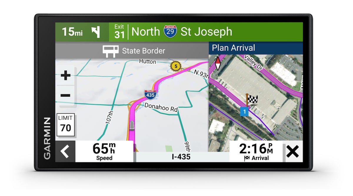
| State and county border notices | |
| Specialized truck routing | |
| Simple truck profile | |
| Popular truck route data | |
| Mile marker information | |
| Mile marker information | |
| IFTA fuel logging capability | |
| Hours-of-service violation warnings |
Once I was on my way, the Garmin Dezl OTR810 provided great viewing and operated with detail.
There are a few changes in how to find truck stops, parking and rest areas, but I found they really are more detailed than previous models. On this model, you can enter your truck stop reward cards for fueling and shower request updates. Without downloading, I wasn’t sure if I could mobile fuel, reserve parking or receive my reward points, but the feature to attach your rewards seemed very simple once again with Wi-Fi.
What I love is that someone has finally made a trucking GPS with a bird’s-eye satellite view of a dock and most entrances. I have asked for years why in the world we can’t get a totally satellite view across the board like Google maps. But with this Garmin, there is a choice of a satellite view of your shippers’ and receivers’ facilities. This one also directed me into the truck entrances rather than an address of an entrance — which is usually the main entrance.

The distance and arrival times are still accurate, but I found the weigh station distance no longer was showing. My Dezl 785 shows when you are within 5 miles of a weigh station and then counts down until arrival. I do miss that feature in the new 810, especially when in high-traffic areas and juggling with other trucks getting into the right lane for the scales.
Another feature of Dezl OTR810 allows you to add your prepass so that your weigh station bypass will show on your screen.
Riding down the highway with so many details of what’s ahead and how to plan my day makes the Garmin Dezl 810 a great tool. With so many highways and roads in America, navigation isn’t just about what road to take to get to my destination, It’s about what’s along the way to help me make my travels easier and safer.
With the Dezl 810 features, I find there are more options that help make it an all-in-one device no matter where you go or what you drive.


