The 2020 Atlantic hurricane outlook looks even more gloomy.than a month ago, when the Colorado State University (CSU) Department of Atmospheric Sciences said its initial forecasts in early spring needed adjustments.
CSU meteorologists issued another update on August 5, increasing their forecast and calling for an extremely active 2020 season.
For carriers and their drivers preparing for a busy hurricane season, what matters most is how many storms make landfall and where they hit. With this season getting off to an early start, and a high chance of a busy season, the time to prepare is now.

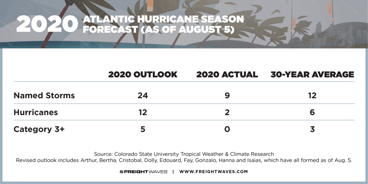
The CSU meteorologists now predict 24 total named storms in the Atlantic basin, instead of 20. This includes the Gulf of Mexico, the Caribbean and the western Atlantic. They have also increased their predicted number of hurricanes from nine to 12, and the number of major hurricanes (Category 3 or higher) from four to five. From 1981 through 2010, the average number of named storms in an Atlantic season was 12, with six hurricanes and three major hurricanes.
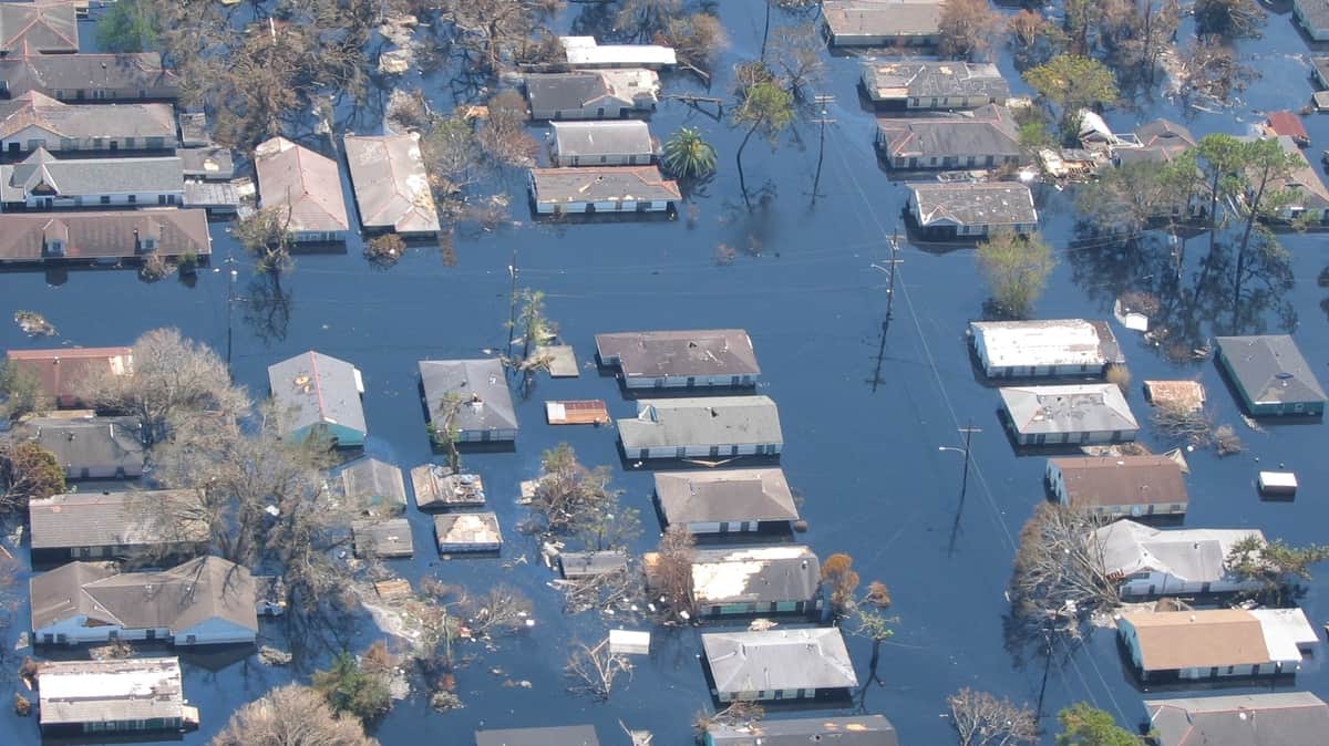
The last season with 24 or more named storms was 2005, the year Hurricane Katrina devastated New Orleans and other parts of the Gulf Coast. A record 28 storms were named, with 15 hurricanes and seven major hurricanes. The last six storm names started with Greek letters since the previous ones depleted the English alphabet.
So far this year there have been nine named storms, two hurricanes and no major hurricanes.
One reason CSU experts expect so many storms is because sea surface temperatures (SSTs) averaged across the tropical Atlantic are much warmer than normal, with widespread 80s along the U.S. Gulf Coast. Warmer than normal water across the tropical Atlantic provides more fuel for cyclone development, and is associated with lower than normal atmospheric pressure (as was observed in July) and increased instability – all of which favor more hurricane development.

(Photo: Lt. Commander Mark Doran, NOAA Corps)
CSU is also expecting weak La Niña conditions by late summer. La Niña typically reduces wind shear over the Atlantic, and vertical wind shear in July was extremely low. Wind shear – increasing wind speed with altitude and/or change in wind direction with altitude – can shred tropical systems, keeping them from developing into destructive tropical storms or major hurricanes. But with less shear, the odds for intense cyclones could increase.
Considering all the factors, CSU experts anticipate an above-normal chance of major hurricanes making landfall in the Caribbean and along the continental United States coastline.
Specifically, for the U.S. East Coast (including the Florida Peninsula), CSU pegs the odds of at least one major hurricane hit at 49%. The full-season average is 31%. The odds for the Gulf Coast from the Florida Panhandle to Brownsville, Texas is 48%, with a full-season average for this area is 30%.
For the Caribbean, CSU has a 63% chance of at least one major hurricane strike, about 20% higher than the full-season average.
This is the 37th year for CSU’s Atlantic hurricane season outlook. It will issue two-week forecasts for Atlantic tropical cyclone activity during the peak of the season from August through October. The next report will be August 19.


