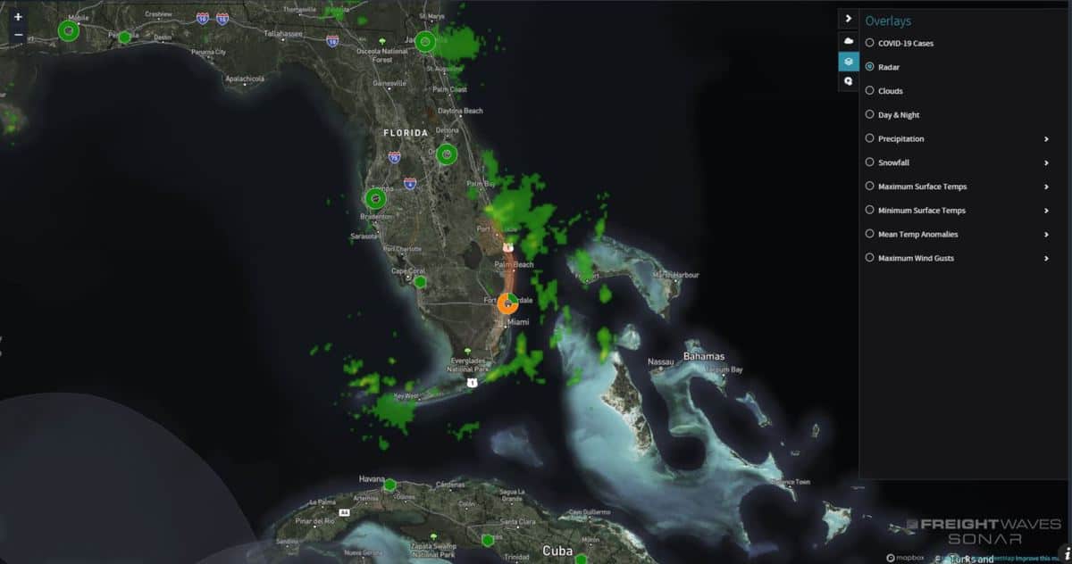
Parts of southern Florida got slammed with heavy thunderstorms and flash flooding early Thursday.

According to reports from local law enforcement and emergency management, some places from Fort Pierce to Boca Raton were doused with 3 to 7 inches of rainfall early Thursday. The National Weather Service issued flash flood warnings for these areas based on the reports as well as radar. The warnings expire at 9 a.m. EDT Thursday.
Setup and rainfall amounts
Heavy thunderstorms rolled through southeastern Florida as energy traveled along a stationary front that has stalled over the area. The storms are gradually moving offshore, but this process could happen several more times through the weekend. Each round of storms could produce similar rainfall amounts, along with flash flooding.
There is also a cluster of showers and thunderstorms located over the west-central Caribbean Sea. These storms are associated with a tropical wave in this region. A broad area of low pressure is expected to form Friday or Saturday over the northwest Caribbean Sea or the extreme southern Gulf of Mexico in the vicinity of the wave as it moves slowly to the west-northwest.
Conditions will likely be favorable for development thereafter in that region, and a tropical depression or tropical storm could form over the weekend as the system meanders. The National Hurricane Center is pegging the odds of this happening at 70%. If it becomes a tropical storm, its name will be Gamma.
This system could produce heavy rainfall in portions of Belize, the Yucatan Peninsula and western Cuba. But it will also keep tropical moisture flowing into southern Florida, adding to the likelihood of occasional torrential downpours followed by episodes of flash flooding.
Impact on freight
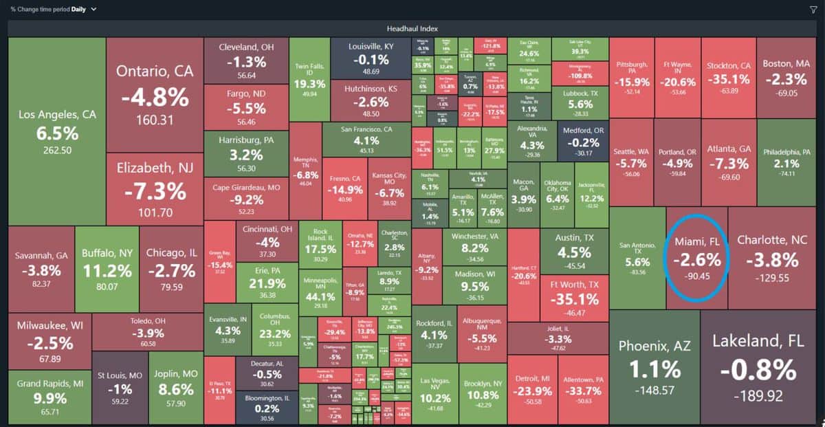
The areas of highest impact from potential flooding are in the Miami freight market, where many drivers may be dropping off loads over the next several days. This is evident based on the latest data from FreightWaves SONAR. Miami has the fifth-lowest Headhaul Index (HAUL.MIA) of the 135 U.S. markets. Headhaul measures the spread in a market’s outbound loads versus inbound loads.

Miami’s headhaul value of -90 indicates more freight is entering the market than leaving it. So there’s loose capacity — plenty of trucks — but drivers may have to deadhead somewhere else to find their next loads to pick up or they will have to wait for more outbound freight to become available in Miami.
Drivers heading to the Miami market with freight will hit minor delays due to the potential periods of heavy rainfall. They should be ready for at least minor delays from possible ramp and road closures along Interstates 75 and 95 as well as U.S. Highway 1.


