Severe thunderstorms slammed portions of the northern Great Plains Monday, with more than 30 reports of large hail and damaging winds in North and South Dakota, and one tornado in North Dakota.
A wind gust of 84 mph was recorded at the North Dakota Department of Transportation’s Grassy Butte weather station. Winds of 80 mph were measured near New Town and Bears Lodge, North Dakota, with gusts of more than 60 mph in parts of South Dakota. Trees and power lines were blown in many locations.
A fairly slow-moving cold front moving across the nation’s heartland will spark more storms today and tonight, with severe winds and large hail at the top of the threat list. A tornado or two, as well as spots of potential flooding, are possible, and some storms could produce abundant cloud-to-ground lightning.
Most of the severe storms will hit from central and eastern portions of the Dakotas to northern and eastern Nebraska. This includes Bismarck, North Dakota; Pierre and Sioux Falls, South Dakota; and Norfolk, Nebraska. Drivers will likely run into delays on portions of Interstates 29, 90 and 94.
A few isolated severe storms could develop as far south as Omaha and Lincoln, Nebraska, as far east as Minneapolis, Minnesota and as far west as eastern Montana.
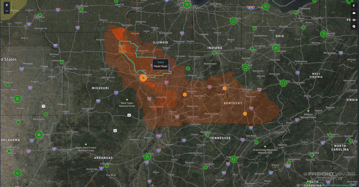
Isolated severe storms may also hit the middle Mississippi Valley in parts of Illinois, Missouri, Indiana and Kentucky, from St. Louis to Cape Girardeau, Evansville, Bowling Green and Lexington.
However, flooding will be a bigger threat in these areas compared to winds and hail. Periods of heavy rainfall could drench some of the same spots over and over (with brief rain-free periods in between the downpours). This process is called “training,” and often causes creeks, streams and some rivers to rise rapidly, particularly flooding low-lying and poor drainage areas.

Rainfall rates will be intense at times, reducing visibility. Totals of 3 to 5 inches will be common across this region through Wednesday. The National Weather Service has issued flash flood watches, in effect through Wednesday morning for now.
Click here for more FreightWaves articles by Nick Austin.


