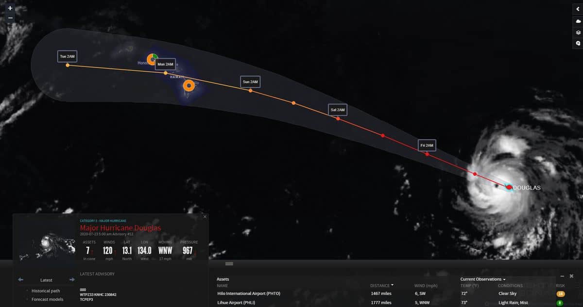
Hurricane Douglas is now a major hurricane, and the first hurricane of the 2020 eastern Pacific season. It may make landfall in Hawaii this weekend.

Douglas went from a non-named cluster of thunderstorms last Sunday, July 19, to a tropical storm three days later. Just a few hours later, as the storm hit warmer waters and less wind shear, it became a hurricane.
Maximum sustained winds have increased to 120 mph, making Douglas a major Category 3 hurricane as of 5 a.m. EDT today, 11 p.m. Hawaii Standard Time (HST) Wednesday, when the National Hurricane Center (NHC) issued its latest report. At that time, Douglas was centered about 1,470 miles east-southeast of Hilo, Hawaii, based on measurements taken by U.S. Air Force hurricane hunters. Hurricane force winds were extending up to 25 miles from the eye, and tropical storm force winds extend up to 105 miles from the eye.
With Douglas still far away from Hawaii, it’s too early to pinpoint how close it will come to landfall there. The most likely forecast track, at this point, has Douglas making a direct hit as a high-end tropical storm or low-end hurricane on the northern end of the “Big Island” on Sunday, July 26. Wind, waves and rainfall would likely increase the day before.
With Douglas still a few days from a potential landfall, there is time to prepare for possible impacts to businesses and supply chain networks from Hilo to Honolulu and Pearl Harbor, as well as container and cruise ship operations.
Because Hawaii is such a small target in a very large ocean, hurricanes have made landfall there only twice since 1959. The latest was Hurricane Iniki in September 1992, a Category 4 hurricane with winds of 145 mph that killed six people.
The outlook for Hurricane Douglas is subject to minor adjustments. Look for more updates on the FreightWaves website and social media accounts in the coming days.
Gulf of Mexico
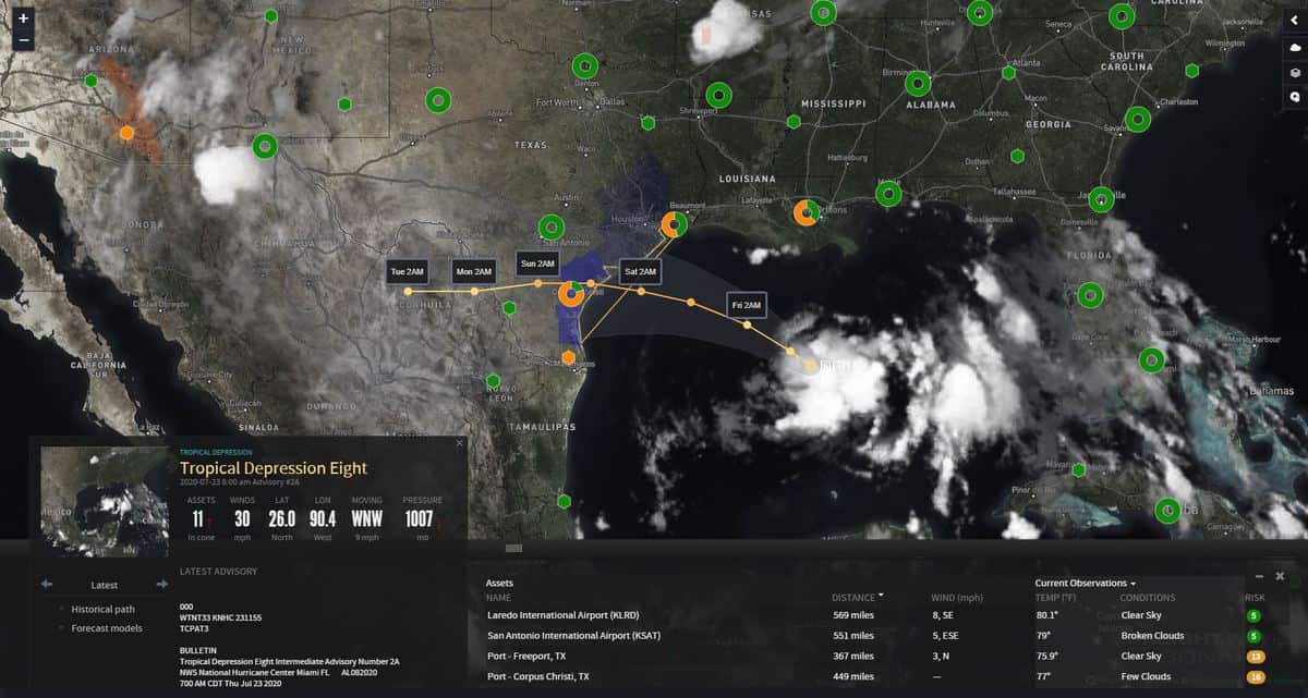
Tropical depression eight (TD-8) in the Gulf of Mexico will likely become more organized later today into Friday.

At 5 a.m. EDT Thursday, TD-8 was centered about 425 miles east-southeast of Port O’Connor, Texas, which is just north of Corpus Christi. The NHC has issued a Tropical Storm Watch for most of the Texas coast, as TD-8 could gain strength and become Tropical Storm Hanna prior to landfall Saturday.
Parts of eastern Texas could get drenched with 4 to 8 inches of rainfall this weekend, with a risk of flash flooding. Minor to moderate wind damage is also possible.
In the Atlantic
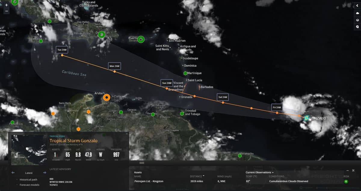
Tropical Storm Gonzalo will continue its journey toward the Caribbean over the next few days, moving through the Windward Islands this weekend.

By early next week, Gonzalo could end up just south of Haiti and the Dominican Republic, but will not be a concern for the United States for at least the next week or so, unless the storm takes a sudden turn toward Puerto Rico at some point.
Click here for more FreightWaves articles by Nick Austin.


