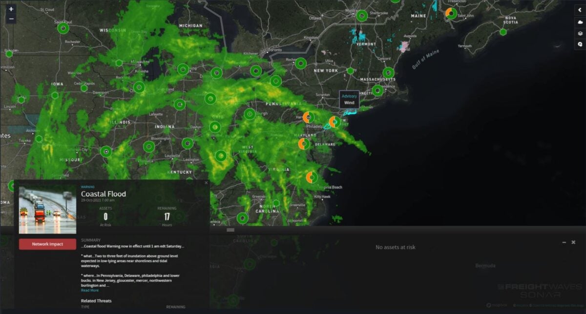
Millions of people are under alerts for coastal and inland flooding across the mid-Atlantic this weekend as a large and powerful low-pressure system moves toward the region.
“Right now we’re expecting it to be one of the worst tidal flooding events that we’ve had in the past 10 or 20 years for a lot of locations in the Chesapeake Bay watershed,” Chris Strong, a meteorologist at the National Weather Service office in Sterling, Virginia, told CNN. “The biggest impact that we’re expecting here in the Baltimore/Washington area and along the Chesapeake Bay is the tidal flooding.”
Flooding is expected to peak Friday, most likely in the evening, and linger through Saturday. The NWS is forecasting 2 to 4 feet of coastal flooding and 2 to 4 inches of rain.
The last time conditions were this bad was during Hurricane Isabel in 2003. During that storm, Fell’s Point in Baltimore, the U.S. Naval Academy, downtown Annapolis and the Belle View neighborhoods of northern Fairfax County, Virginia, all experienced severe storm surge flooding, according to the National Oceanic and Atmospheric Administration.

While Strong warns that the flooding with Isabel was several feet higher than what is expected from this weekend’s storm, it will be one of the worst tidal flooding events since that hurricane.
The river gauge for Chesapeake Bay at Cambridge, Maryland, is forecast to reach over 5 feet. This would make it the second-highest tide on record, behind a height of 6.2 feet in 2003 during Isabel.
“Usually, when we have tidal events this extreme, it’s usually from hurricanes or tropical events,” Strong added. “This is just low pressure moving in, but that strong low pressure is working against high pressure over New England to our north. That combination is driving the easterly flow right off the Atlantic Ocean and piling all that Atlantic ocean water on the shoreline and up the Chesapeake Bay.”
Wind advisories have been posted for Long Island, as well as from Newark, New Jersey, to New London, Connecticut, where wind gusts could reach 50 mph.
Major lane of concern
• Interstate 95 from New London to Washington.
Other notable weekend weather
High winds Friday will raise the risk for rollovers along the Interstate 10 corridor from Mobile, Alabama, to Tallahassee, Florida, as well as places inland such as Albany, Georgia, and Dothan, Alabama. Gusts in these areas will range from 35 to 50 mph.
Also look for windy conditions Friday from West Virginia to portions of western Pennsylvania. Gusts will hit 45 to 55 mph from Snowshoe and Elkins to Johnstown and Somerset.
Click here for more FreightWaves articles by Nick Austin.
You might also like:
Truckers who died helping accident victims named Highway Angels
Rollover alleys: 5 Interstate stretches that pose greatest risk
Colorado trucking company takes ‘huge hit’ from I-70 closures
Self-described ‘shaman’ arrested in California wildfire arson


