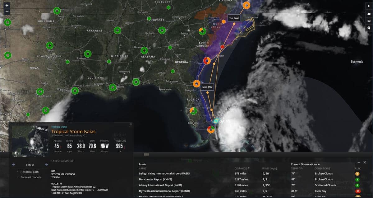
Mid-Atlantic container and break-bulk ports made final preparations on Sunday for Tropical Storm Isaias as it weakened from hurricane status over the weekend.
The North Carolina ports of Wilmington, which handles containers, and Morehead City, which specializes in breakbulk cargo, were operating under normal conditions on Sunday afternoon, with a decision to be made late in the day for operations on Monday.
Container, breakbulk, and roll-on/roll-off terminals operated by the Port of Virginia will remain open and operate per standard schedules on Monday, according to an update released by the port on Sunday afternoon.

“Our senior operating and safety teams will meet tomorrow morning, August 3, to process the latest information from the National Weather Service and the USCG [U.S. Coast Guard],” the port stated in its update. “We will deliver another public message to the trade by early afternoon on Monday, August 3. That message will include an outline of our operating plan for Tuesday, August 4.”
The USCG set “Port Condition X-Ray” at both port areas on Sunday morning, which means sustained gale force winds are expected within 48 hours. Condition X-Ray means all oceangoing commercial vessels and barges greater than 500 gross tons should make plans for departing the ports, according to the Coast Guard. Vessels desiring to remain in port were required to submit a mooring plan to the captains of the port for approval.
Georgia and South Carolina port authorities, which operate container terminals at Savannah and Charleston, respectively, were closely monitoring the storm on Sunday and planned normal operating hours on Monday.
As of 2 p.m. EDT Sunday, Isaias was just off the east-central Florida coast, moving slowly north-northwestward, according to the National Weather Service (NWS). “Tropical Storm Isaias is forecast to move northward and make landfall over parts of the Carolinas on Monday,” NWS stated.
“While Isaias is no longer forecast to restrengthen into a hurricane … dangerous storm surge of 2 to 4 feet is expected in some coastal areas of Florida. Isaias is then forecast to move north toward the Carolinas and make landfall there Monday night, causing high winds. Heavy rainfall totals are expected to cause potentially life-threatening flash flooding over the Carolinas and then the Mid-Atlantic Monday and Tuesday as Isaias moves north.”


