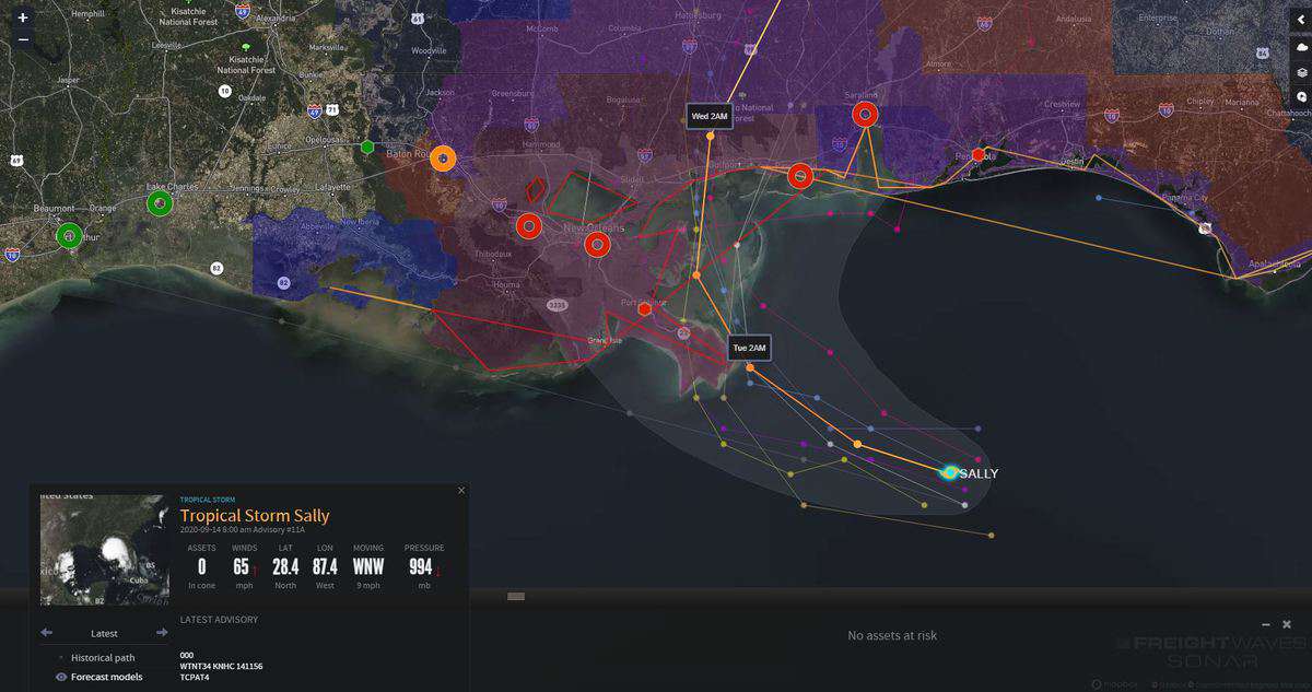
Updated Monday, Sep. 14, 10 a.m. EDT.
There’s no rest for the weary as the 2020 Atlantic hurricane season shows no signs of abating anytime soon.
Tropical Storm Sally — the eighteenth named storm of the season — could soon become the sixth hurricane of the season, just prior to landfall in the U.S. central Gulf Coast.
In response, the U.S. Coast Guard (USCG) has set restrictions on vessel movement and cargo operations at some Gulf Coast ports:
USCG Mobile, Alabama sector
USCG New Orleans sector

The National Hurricane Center (NHC) has issued a hurricane warning from Morgan City, Louisiana to Mississippi-Alabama border, as well as for Lake Ponchartrain, Lake Maurepas, and the New Orleans metropolitan area.
A storm surge warning is in effect from Port Fourchon, Louisiana to the Alabama-Florida border, in addition to Lake Ponchartrain, Lake Maurepas,Lake Borgne and Mobile Bay.
The NHC has posted a tropical storm warning from the Mississippi-Alabama border to Indian Pass, Florida, as well as from Intracoastal City, Louisiana to Morgan City, Louisiana.
As of 8 a.m. Eastern Standard Time Monday, Sally was 115 miles east-southeast of Louisiana’s southeastern coast. Sustained winds had increased to 65 mph from 50 mph Sunday, and will likely reach Category 1 hurricane strength by Monday evening. Sally will then hit the Louisiana coast later in the evening/overnight.
Some parts of the northern Gulf Coast could see 8 to 16 inches of total rainfall through mid-week, with isolated amounts of up to 24 inches. Dangerous storm surge of 8 to 12 feet will cause flash flooding and potential road closures.


