Oppressive heat and humidity will spread across parts of the Plains and the South over the next two days. For some areas it will be around Tuesday or Wednesday, but in some places it will last both days. The National Weather Service has issued various heat alerts across these regions.
Plains
The high heat will hit central and eastern Montana, where some wildfires are burning. Places such as Helena, Great Falls, Billings, Glendive, Havre and Glasgow are under either a heat advisory or an excessive heat warning. Temperatures will range from the mid-90s to about 110 degrees Tuesday.
To prevent new fires, drivers can do their part by not parking in grassy areas and not dragging chains.
In the western half of North Dakota, highs will reach the 90s Tuesday in Bismarck, Williston and Dickinson, with heat index levels up to 105 degrees. The heat index will be close to 105 degrees Tuesday and Wednesday across many parts of South Dakota.
From Nebraska to far eastern Texas, as well as the upper and middle Mississippi valleys, the heat index will be even more uncomfortable and dangerous, ranging from 105 to 110 Tuesday and Wednesday in some locations. This includes Omaha and Lincoln, Nebraska; Minneapolis; Des Moines, Iowa; western Illinois; St. Louis, Kansas City and Springfield, Missouri; Wichita and Topeka, Kansas; Tulsa, Oklahoma; in addition to Texarkana, Tyler and Lufkin, Texas.
Deep South
The combination of temperatures in the 90s and sweltering mugginess will produce a heat index near 110 degrees Tuesday and Wednesday in parts of the lower Mississippi Valley and the Southeast.
Notably, truckers should be extra careful in places like New Orleans, Baton Rouge, Shreveport and Monroe, Louisiana; Birmingham and Montgomery, Alabama; Macon, Georgia; as well as most of Mississippi and Arkansas.
Besides drinking plenty of water, other things drivers can do to stay cool include driving at night as much as possible and covering their drivers’ seats with a light-colored blanket when they aren’t in their trucks.
Impact on freight
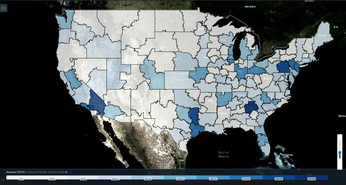
The FreightWaves SONAR Outbound Tender Volume Index (OTVI) is a moving index representing loads electronically offered by shippers to carriers. Markets in blue indicate higher OTVI values than those in white. The darker the blue, the higher the OTVI level.

Except for the northern Plains and upper Mississippi Valley, many of the freight markets in the building heat wave have medium to high levels of outbound freight available for carriers, meaning more truckers may be heading there to pick up loads on these excessively hot days.
Click here for more FreightWaves articles by Nick Austin.
You might also like:
Most dangerous highway stretches for US truckers
‘Painful mess’: I-40 bridge closure costing trucking industry $1M daily
Trucker named Highway Angel for rescuing driver from burning car


