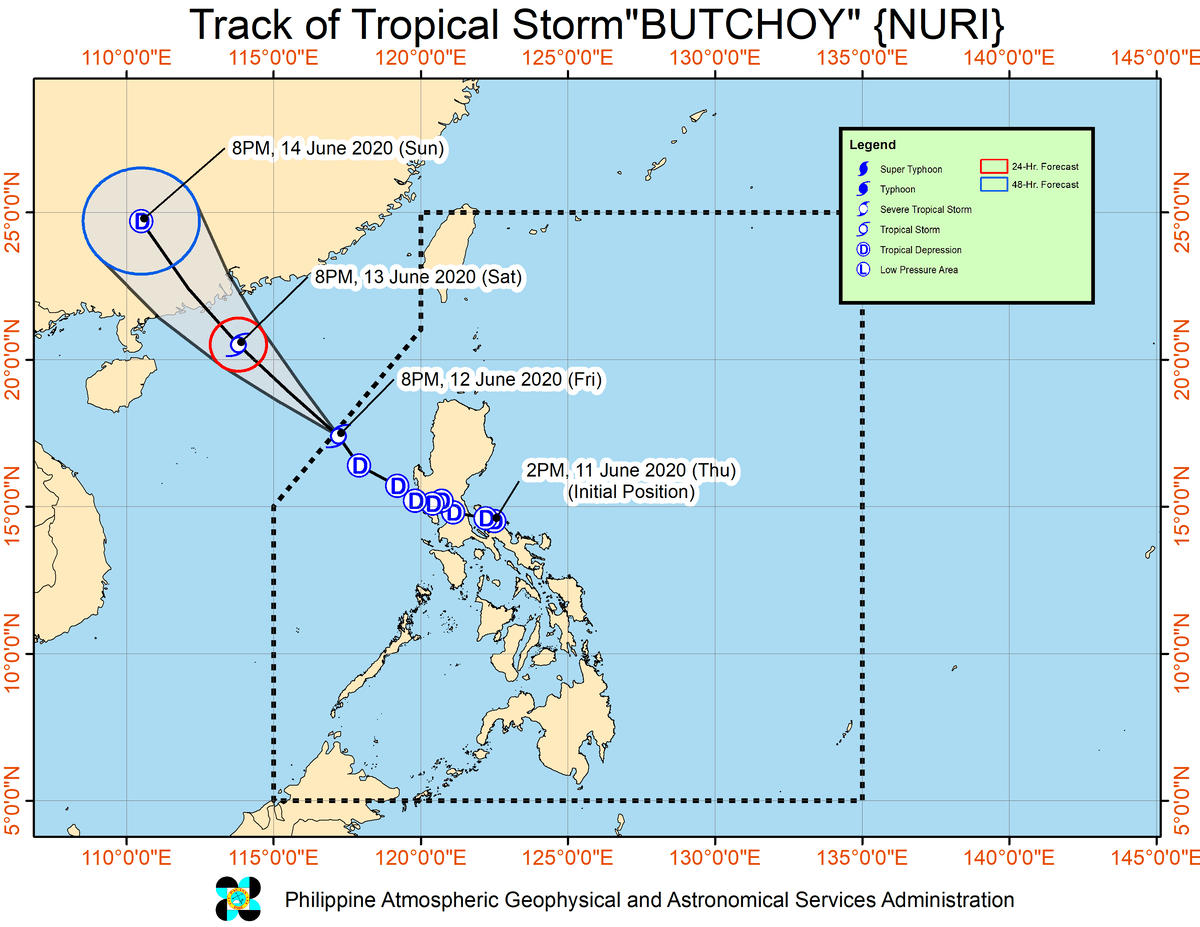
On Wednesday, Tropical Storm Butchoy was just a cluster of thunderstorms over that nation. FreightWaves reported on the potential for this storm to intensify, and now mainland China is bracing for impact.
The storm — known as Tropical Storm Nuri in China — will travel across the South China Sea this weekend, maintaining tropical storm status. As of 11 a.m. EDT Friday (11 p.m. Friday Hong Kong time), its sustained winds were 40 mph, with gusts of 50.
The Hong Kong Observatory (HKO) has issued a T1 tropical cyclone warning. This indicates that a tropical cyclone is centered within 500 miles (800 km) of Hong Kong, which may affect the city and its ports.
Winds and swells in Hong Kong are expected to gradually increase Saturday. The HKO will consider issuing the T3 strong wind warning depending on how badly conditions deteriorate. Meteorologists with the HKO are predicting gale force winds up to 54 mph for Saturday, flirting with severe tropical storm status (55 to 73 mph).

There’s a slim chance Nuri could strengthen into a typhoon — winds of at least 74 mph, like an Atlantic hurricane.
Periods of heavy rainfall and thunderstorm squalls may cause rough seas, slowing down loading and unloading of container ships at the Port of Hong Kong, as well as other ports. Nuri could make landfall anywhere from Hong Kong to the Port of Shui Dong, around 180 miles to the southwest.
Hong Kong is one of the busiest container ports in the world, according to the Hong Kong Maritime and Port Board website. It handled 18.3 million twenty-foot equivalent units (TEUs) in 2019, and provided about 300 container liner services per week connecting to around 420 destinations worldwide. It’s also the fourth-largest container port is China, behind Shanghai, Shenzhen and Ningbo-Zhoushan, according to iContainers.com.
As of 2 p.m. EDT Friday, the Port of Hong Kong had not posted any social media or website messages regarding suspension of its container cargo, cruise liner or ferry services.


