Messy weather will make hauling freight this weekend a bit tricky, or even dangerous through some parts of the U.S. A significant storm will drop lots of snow across the Mountain Prairie region, with lighter amounts in parts of the Midwest region. Some roads could become icy from freezing drizzle.

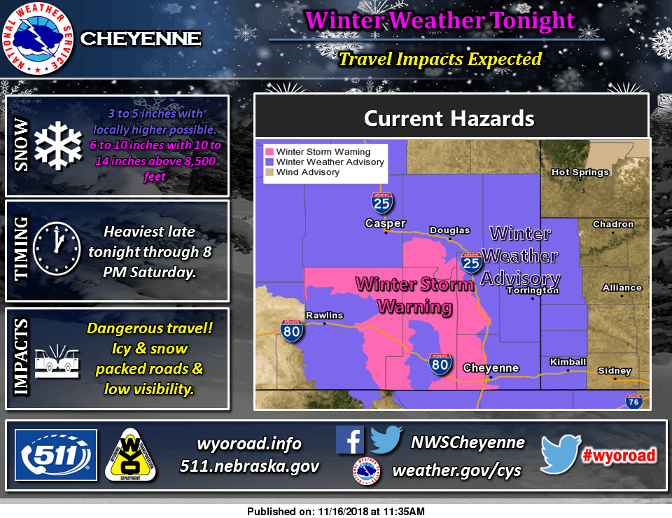
The heaviest snowfall will be Friday evening through Saturday across Wyoming, with blowing snow at times. Fleet managers will have to plan ahead, and truckers will have to plan their breaks to coincide with periods of limited visibility. More than 12 inches could pile up in the highest peaks of southeastern Wyoming, with several inches in the lower elevations. Parts of Colorado will see up to six inches of snow.
Here’s the breakdown.
COLORADO
Area 1
-
Portions of east central, north central, and northeastern Colorado, including the I-25 corridor from the Wyoming border through Denver and the Palmer Divide.
-
Total snow accumulations of up to two inches expected and ice accumulations of less than one tenth of an inch.
Area 2
-
Foothills of the Northern and Southern Front Ranges.
-
Total snow accumulations of three to six inches expected and ice accumulations of less than one tenth of an inch. The heaviest snow accumulations can be expected in the foothills of Larimer and Boulder counties to the northwest of Denver.
Area 3
-
Rabbit Ears Pass, Rocky Mountain National Park, and the Medicine Bow Range.
-
Total snow accumulations of four to eight inches expected with the heaviest snow in the Medicine Bow Range and Rocky Mountain National Park area.
WYOMING
-
Target areas Includes the cities of Albany, Arlington, Bordeaux, Buford, Centennial, Elk Mountain, Federal, Garrett, Horse Creek, Medicine Bow, Pumpkin Vine, Seminoe Dam, Shirley Basin, Vedauwoo, and Whitaker.
-
Total snow accumulations of five to nine inches are forecast for elevations below 7,000 feet and over the Interstate 80 Summit, with 10 to 14 inches over the North Laramie and Snowy Ranges.
-
Major routes affected will be I-25, I-80, and I-90.
Up to five inches of snow will also fall in parts of northern Iowa, southern and western Minnesota, western Nebraska, eastern portions of North and South Dakota, and southern Wisconsin. This will slow down drivers on I-35, I-90, and I-94. Check chain laws here for the latest updates on winter driving.
Also, the National Weather Service has issued Winter Weather Advisories and Winter Storm Warnings. Forecasts can change a bit, so check details on this interactive map. Temperatures won’t get above freezing for many of the Watch and Warning areas, so fuel gelling and batteries with low CCA values may cause delays.

Another area of concern for this weekend is the West region. As large, destructive wildfires continue to burn in northern and southern California, sections of some roads remain closed. Interstates look fine right now, but drivers might run into some delays getting deliveries and loads of relief supplies into the Los Angeles and Sacramento metro areas. Look for updates on this web site.
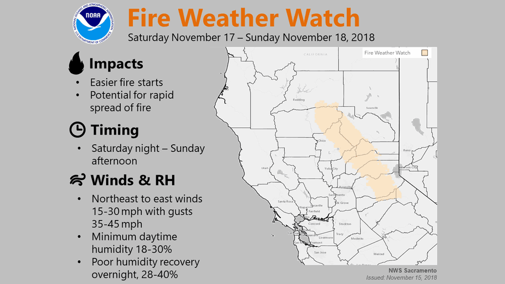
Winds will pick up again Saturday and Sunday in northern California, increasing the wildfire risk from Sacramento northward toward Redding. Current or new fires could spread quickly, like the Camp, Hill, and Woolsey Fires did last week. The winds will also make deadheading or hauling light loads difficult. Smoke from the fires will continue to be a health hazard, so drivers should take their breaks indoors and wear an N95 mask while outdoors. This is the type recommended by FEMA and health officials.


