Heavy rain began soaking parts of California last night, flooding roads and drowning cars. At times, the rain was coming down at a rate of at least one-half inch per hour, being blown sideways by powerful winds. It’s all because of an atmospheric river of moisture off the Pacific called the Pineapple Express.
Central California Chaos

The San Francisco area has been hit the hardest so far with 1.70 inches as of 11:00 a.m. Pacific Standard Time today (February 13). Other areas have received two to three inches, and right now Venado (just north of Santa Rosa) tops the list with 5.08 inches. Rain is typical in this region during the winter, but it’s not always this much all at once.
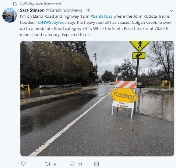
Flooding has been reported in several areas, including Santa Cruz (cover photo), Walnut Creek (just east of Oakland), Novato (just north of San Francisco), Ocean Beach, and portions of Wine Country in Sonoma County, just to name a few. Police tape was stretched across barricades to block people from driving through areas of high water, and “road closed” signs were posted in other spots. But some drivers didn’t obey the warnings and got stuck.
Nobody, including truckers, should try to drive through flooded areas. You may not end up as fortunate as the driver who survived the flooding in the cover photo. Water two-feet deep will make most cars float, and moving water can send you down the river fast. On average, in the past 30 years, flooding has caused the second-most number of weather-related deaths in the U.S. Around half of those deaths happened in vehicles. Also, it’s easy to underestimate how deep the water may be. Your vehicle could stall, or the road could be washed out, leaving you in a sinkhole.
Excessive runoff has been causing creeks, streams and rivers to rise, and storm drains can’t handle the rushing rains. All kinds of communities are becoming waterlogged – residential, commercial, and rural. To make matters worse, the saturated ground is weakening root systems. Large trees have been toppling with ease as strong winds accompany the downpours. In some cases, the trees have fallen onto homes and power lines, adding to the hazardous conditions. Hurricane-force wind gusts of 75 mph were recorded near Pine Grove in Amador County.
Several more inches of rain could fall before the last of the storm clears out late Thursday. Winds will stay strong, too. The National Weather Service has issued alerts for high winds, in addition to Flood Warnings for the following waterways and alerts for urban flooding:
• Napa River near Napa
• Navarro River at Navarro affecting Mendocino County
• Eel River at Fernbridge affecting Humboldt County
Besides flooding, there’s also a risk of mudslides, as well as debris flows from scar areas where wildfires burned last year.
Southern California Soaking
Heavy rain will move into the San Diego metro area from this afternoon through Thursday. Flooding is possible in the city where two to four inches could fall, as well as the nearby hills and mountains where totals could exceed four inches. People should prepare for possible wind damage, too, especially in the mountains of Riverside, San Bernardino, and San Diego Counties.
Downpours could also drench parts of the Los Angeles metro area tonight and Thursday, especially to the southeast of the city where Flash Flood Watches have been posted. Fierce winds are forecast to be strongest in Black Mountain, the Dick Smith Wilderness Area, Lockwood Valley, Mount Pinos, San Marcos Pass, and the San Rafael Wilderness area.


