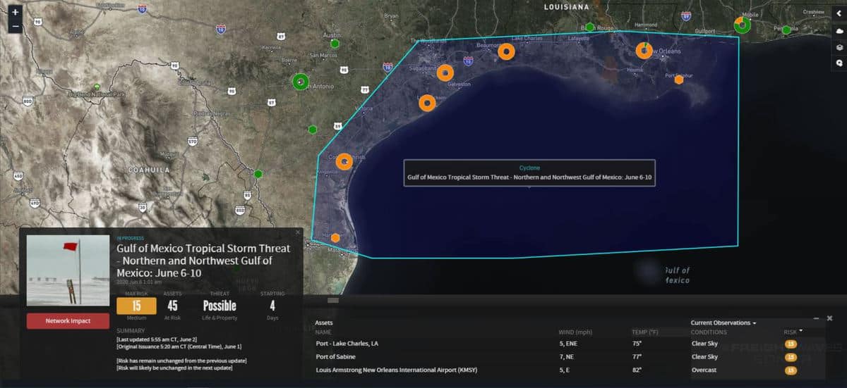
The second landfall of a tropical cyclone this season could hit the Gulf Coast of the United States near the end of the week. The first was Tropical Storm Bertha in late May, making landfall on the South Carolina coast after flooding parts of Florida for three days.
The remnants of Tropical Storm Amanda, which formed in the eastern Pacific Ocean last week, moved across Central America last weekend. The system has re-energized into Tropical Depression Three (TD-3), sitting off the coast of southern Mexico in the warm waters of the Bay of Campeche.
TD-3 will likely become a tropical storm later today or tonight before meandering across southern Mexico and parts of Central America. The National Hurricane Center (NHC) has issued a tropical storm warning for the Mexico coast from Puerto de Veracruz to Campeche. Because Amanda was downgraded to a tropical depression, it will not get its name back if it becomes a tropical storm now that it has entered the Atlantic basin. It would receive the next Atlantic name, which is Cristobal.
TD-3’s circulation is very large and will rotate over this region for the next few days, dropping very heavy rainfall on parts of Guatemala, El Salvador, southern Mexico and southern/western sections of Honduras. When all is said and done, rainfall amounts could be as much as 6 to 12 inches, with some areas receiving 15 inches or more. This will cause major flooding, including in highly vulnerable mountainous areas where mudslides and landslides are possible.

Eventually, steering winds in the upper atmosphere will probably have TD-3/Tropical Storm Cristobal looping back to the north through the Gulf of Mexico this weekend. There’s plenty of fuel to feed the system, with sea surface temperatures of 80 to 85 degrees in much of the Gulf. By early Sunday, June 7, the system will be near the center of the Gulf, and sustained winds may be as high 65 mph by then.
The latest forecast models show potential Tropical Storm Cristobal hitting the Gulf Coast Sunday night/early Monday, causing wind damage and flooding. At this time, it looks like landfall will be somewhere between Houston, Texas and New Orleans, Louisiana. However, it could hit anywhere from southern Texas to southern Mississippi.
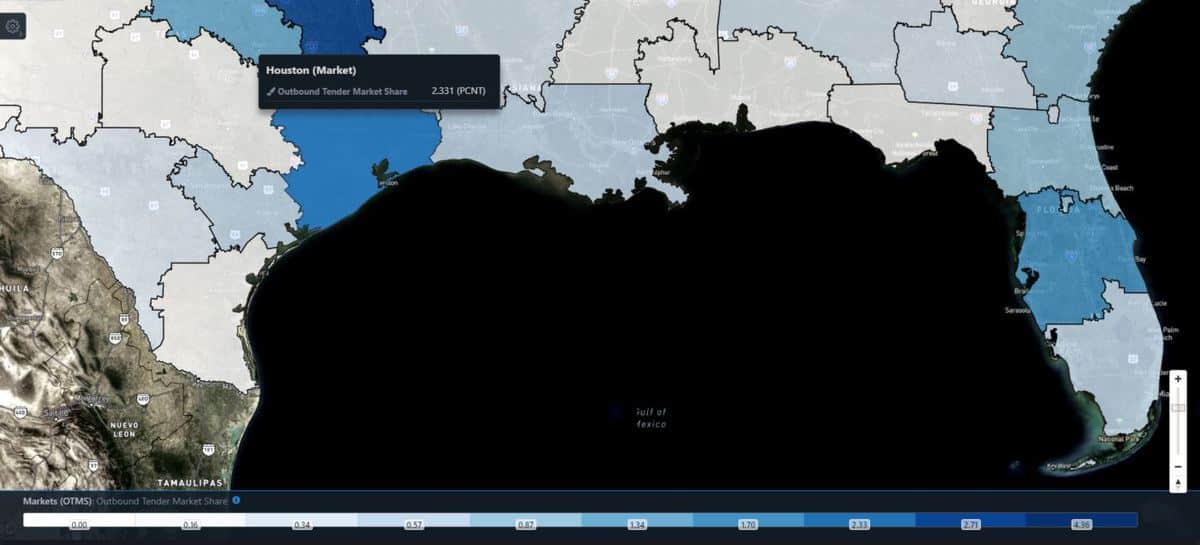
Carriers should watch the situation daily in order to secure available freight before the storm arrives. Houston, a potential landfall location, is one of the largest freight markets in the country.
According to the latest FreightWaves data, updated this morning, Houston ranks eighth out of 135 markets in terms of available outbound freight. Its Outbound Tender Market Share (OTMS) is 2.33%, meaning Houston accounts for 2.33% of the nation’s outbound freight.

Since 1851, when tropical cyclone records began, the third named storm of the Atlantic season has never formed before June 5. Cristobal could become the first to do so. The forecast track, intensity and point of landfall of potential Tropical Storm Cristobal will be adjusted over the coming days. Look for updates on the FreightWaves website and social media accounts.
Have a great day! Please stay healthy and be careful out there!
Click here for more FreightWaves articles by Nick Austin.


