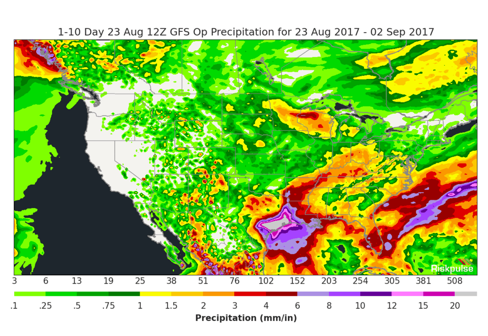
As predicted, the remnants of Tropical Storm Harvey have reformed into a Tropical Depression in the Gulf of Mexico. According to supply chain risk analytics firm Riskpulse, it is now likely that Harvey will make landfall on the south-central Texas coastline, perhaps near Corpus Christi, as a hurricane.
“As Harvey is a small storm, the extent of these hurricane-force winds are expected to also be small,” Riskpulse noted in an update to its Real Time Analysis Feed for Harvey. “The major risk from Harvey will be flooding, with copious to potentially catastrophic amounts of rain possible over the next 7 days between San Antonio, Texas and Baton Rouge, Louisiana, along the I-10 corridor. This includes the Houston metro area, which could be particularly hard hit by flooding.”
The current forecast track has Harvey stalling once it reaches land, creating the potential for up to 20 inches of rainfall in some locations over the next week. Effects are expected to be felt beginning late on Friday.
All the computer models are consistent in this forecast track, Riskpulse noted, although weak upper-level steering currents could still alter the scenario.
As of 7 a.m. this morning, Harvey had winds of 60 mph and was forecast to strengthen into a high-end Category 1 or low-end Category 2 storm, with increased odds of it becoming a major hurricane (Category 3 or higher).
Riskpulse noted that the 10-day rainfall projections from the two main forecast models (the GFS and ECMWF) show some areas could receive a half-year’s worth of rain in that timeframe.
The National Hurricane Center is forecasting a landfall point just north of Corpus Christi in the pre-dawn Saturday morning hours before the storm stalls over Texas, leading to the increased chance of flooding.


